We left Atlantic City via the New Jersey Intercoastal Waterway (NJICW). We’ve read a great deal about this sometimes skinny, often shallow waterway. Our strategy was simple: go slow, stick to the chart plotter and watch the depth gauge, and when the helmsman felt anxious, we both watched and called out the depth.
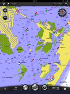
There were spots where the recorded depths were 4 to 5 feet with 1 foot on either side of the channel. We timed our travel to coincide with the rising tide to better our chances. The travel was tedious but we did fine.
Our original plan was to anchor near JoAnn and Scott’s home on Long Beach Island and spend a night or two there. Since our start date changed from 1 May to 8 May, they met us at Cape May and Atlantic City. Instead of an overnight, we gave them a horn blast and a wave as we slowly cruised by. Our sights were now set on Barnegat Bay.
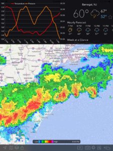
As we passed channel marker R “44,” we headed across to the west side of the bay for anchorage. This was only our second anchorage on this trip, but I will say that it went really smoothly, thanks to our extra time to practice. Not long after setting anchor, I received a NOAA weather alert for Rock Hall (Baltimore, MD, and Washington, DC) on my cell phone. The “Tornado Watch” prompted Pete to check weather radar for our location. It wasn’t pretty.
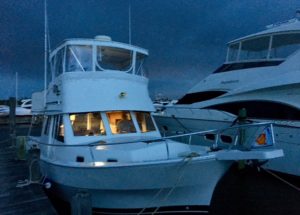
We decided to hoist anchor and take shelter at Key Harbor Marina. We’ve already experienced “Wicked Water” and we have a healthy respect for mother nature. As we tied up near the fuel dock, a marina staffer spotted us and offered us a protected slip, free of charge. Can’t beat that! We motored around the corner, secured our boat, and in a very short time the skies grew dark with storm clouds. In the next hour we were treated to a deluge, complete with lightening and thunder, but minimal wind since we moved behind the marina building.
After a peaceful sleep, we started Leg 5 of our trip. This portion of the NJICW offered better depths most of the way. There were few other boats on the water. Maybe because it was Mother’s Day. The homes lining the route suggested affluence. Some had storm windows, indicating this may be a summer home (a second home), making me wonder what their primary mansion might looked like.
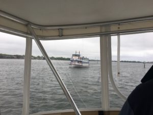
It wasn’t until the Point Pleasant Canal that we sweat some bullets. We had a following current that wanted to push us towards either side of the steel bulkheads. There was oncoming traffic that didn’t follow “the rules.” We breathed a sigh of relief when we saw the end of the canal, only to then see a large paddle boat entering the canal with the Mother’s Day Brunch crowd on board. I’ve since read several articles and blogs that describe this canal as anything but pleasant. (We didn’t get any pictures of the canal passage. We were focused on making it out alive.)
Once in the Manasquan River, we contacted our next marina. We were given excellent directions, and “Sal” met us to assist with tie up on another T-end slip. We were advised of the strong current and tidal changes and made our approach accordingly. Once we were secured and plugged into water and electricity, we met Sal at the Marina Store to pay up and get our “Transient Packet.” The facilities are quite nice. The two on-site restaurants were recommended for Happy Hour. It was a bit early, but I could use a beer.
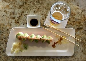
We ordered lunch at the Sand Bar and Grill. Pete had a burger and a Blue Moon. I had “Painted Lady” sushi and Icarus “Yacht Juice” IPA.
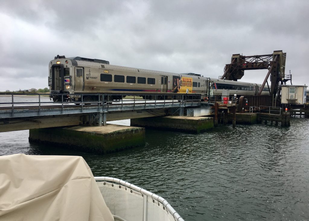
Back on the boat, we realized that the railroad bridge was quite active, carrying Amtrak passengers between New Jersey and New York. The trains ran every 30 minutes until about 9:00 pm. They started back up around 5:30 am. The noise wasn’t too bad, really, nor the whistle that indicated the draw bridge would raise or lower. It was entertaining.
Before going to bed, we carefully planned our departure. The best time to pull away from the dock and get through the draw bridge was at slack tide. We also planned to check lines during the night due to a 6-foot tidal change. Needless to say, it was not our most restful night.
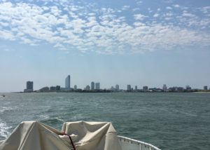
Tomorrow, back to the Atlantic Ocean and on to New York Harbor!
Your adventures are such a pleasure to read! Always looking forward to your next encounter.
loved watching and waving as you passed our home on lbi so glad to have spent time with you in AC and Cape May lots of fun as usual safe travels