At last! Our cooling system has been fixed! We made it to the bottom of Lake Michigan.
No, wait! Let me rephrase that!
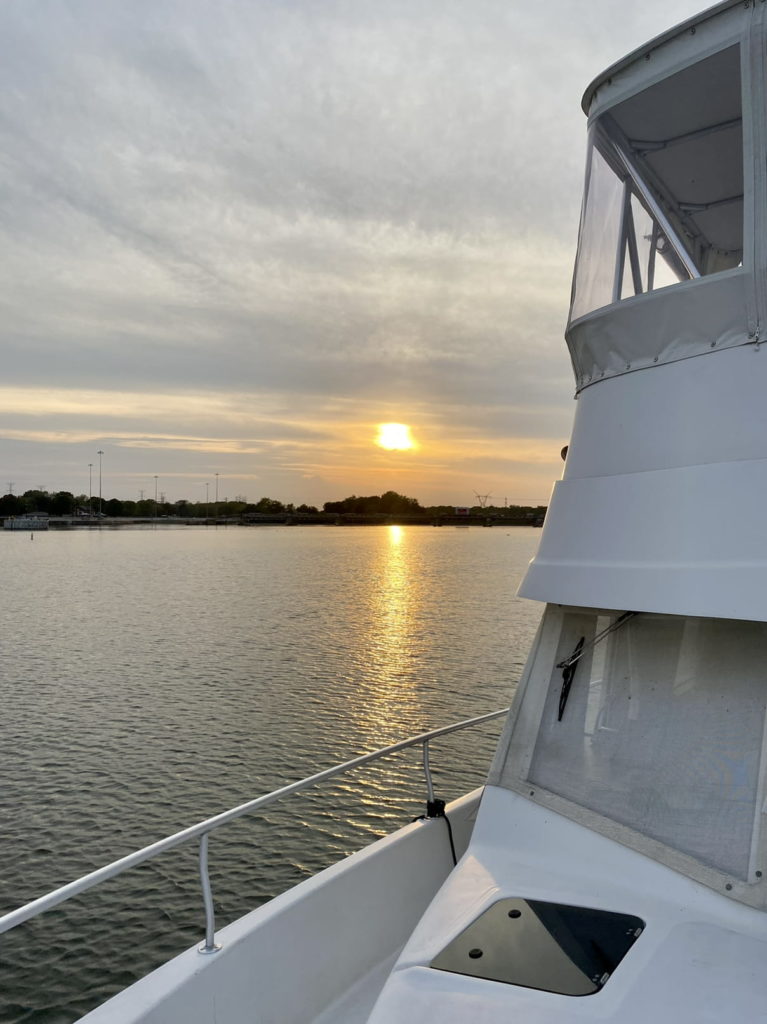
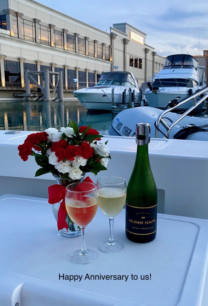
We made it to the Southern Coast of Lake Michigan and our diesel Caterpillar engine purred like a kitten. We stayed in two harbors as we worked our way back to Chicago. Our Michigan City Marina slip was offered by a fellow Looper at no cost! (Thank you, Kacey, on m/v SidePiece!) Hammond Marina is where we fueled up and pumped out. It is also where we celebrated our anniversary with a glass of champagne and a quiet dinner on board.
Phase IV – The Rivers
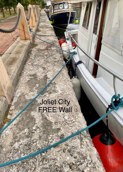
We met George and Barbara of Grand Cru at Hammond Harbor. We both planned an early departure to navigate the bridges and get a spot on the Joliet City free dock wall knowing that it was a popular spot for Loopers.
We have studied the bridge clearances in the Chicago and Calumet Rivers over our several years of planning this adventure. Reverie is too tall for the downtown Chicago River which is why we so enjoyed our floating architectural tour. We have known that the Cal-Sag route would be our only option from the beginning.
According to the United States Army Corps of Engineers and virtually every reference we’ve researched, the limiting clearance on the Cal-Sag route is a nineteen (19) foot fixed bridge. Reverie’s air draft is 16.4-feet, under the requirement.
We focused most of our mental energy on that fixed bridge, not immediately recalling that there are two or three other bridges of less than 19 feet clearance. These are bascule-type (drawbridges) and they will open for pleasure craft on request and given adequate notice.
There is conflicting information regarding the published clearances. Quimby’s Cruising Guide posts a 17-foot clearance for 100th Street and the 106th Street bridges. The US Army Corps of Engineers posts 18.5 feet and 19.4 feet respectively.
As we descended the Calumet river, 100th Street comes before 106th Street. If we can get under the first bridge (18.5) then we can certainly clear the second bridge without difficulty.
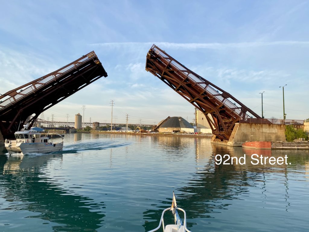
The 92nd Street bridge, with a USACE posted clearance of 19.1 feet, was opening for another upbound boater and therefore we could motor downbound without anxiety. The next bridge of concern was the 100th Street bridge. Pete very slowly approached the bridge. I climbed the chair behind the hardtop. I could see that we had about 3 feet of clearance so we carefully moved forward. Maintaining our caution, Pete approached the 106th Street bridge, expecting to have even more of a cushion.
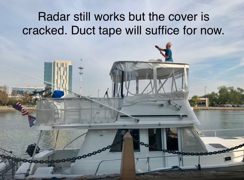
At the last possible moment, I recognized that motor traffic on this drawbridge causes the mid-section to dip and that the clearance was NOT more generous, but extremely tight. Just as we passed under center of the bridge a very heavy truck must have driven directly over us. I heard a loud “BANG!” so I ducked under our hardtop. Next, it looked like pieces of rusty bridge shrapnel reigned down, along with a few pieces of plastic. “Pete, I think our radar dome got hit!” When we cleared the bridge, Pete put the motor in idle and took my position on the chair for a quick assessment. We could not see any damage from our vantage point behind the dome but clearly there was debris on our back deck.
We immediately looked back at Grand Cru, approaching the same bridge. We yelled back, waved our arms, and then Pete tried to contact them by radio. They throttled down, put their boat in reverse, but their forward momentum took their bow and forward antennas under the bridge.
George turned an extended 360 while calling the Bridge Superintendent for a lift. We waited on the other side for the bridge to open, for our buddy boat to come through, and to get a report on conditions. The antennas on Grand Cru suffered some damage.
HINDSIGHT REPORT: The most recent storm with significant winds from the north pushed water into the Calumet River, raising the water level. We did not account for this phenomenon and paid the price.
All subsequent bridges and rail trestles had plenty of clearance. All barges and tugs were relatively small and easy to navigate around, with one exception. The Chicago Sanitary and Ship Canal near Lamont was narrow with barges parked 2-deep on port side. There was an upbound double barge (“2×2” is two barges wide and two barges deep) that requested our passage “on the two,” meaning his starboard to our starboard, putting us in between the parked and moving barges with only about eight feet of turbulent water either side of Reverie. This required incredible concentration and expert maneuvering which Captain Pete managed with finesse.
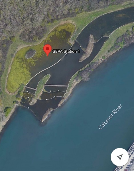
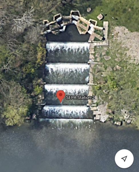
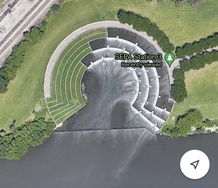
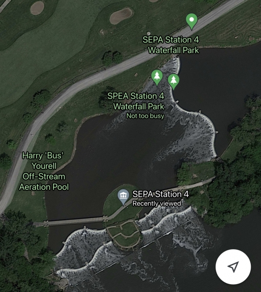
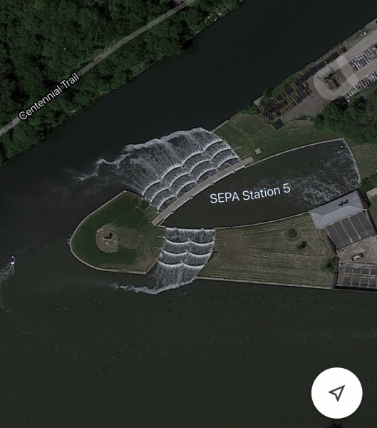
We motored by some very pretty parks with waterfalls that I learned were SEPA Stations. “SEPA” stands for Sidestream Elevated Pool Aeration designed to oxygenate surface water where it can stagnate due to slow water flows. These aeration pools and falls in the Cal-Sag channel help the aquatic species, decrease some pollution concerns and provide parks and trails for the public to enjoy.
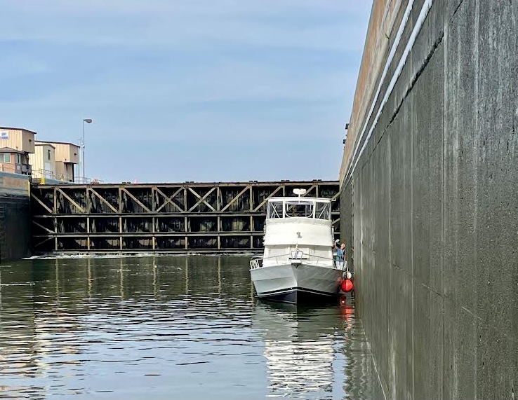
The first two locks of this year’s journey were easy. The first was the Thomas J. O’Brien Lock (a control lock) on the Calumet River. It was a very short drop and we simply floated in the middle of the lock. The second lock, called Lockport Lock, took us down 39 feet to the river just above the city of Joliet where we planned to spend the night.
Just past the West Jefferson Street bridge is the Joliet City municipal park and free dock wall. Two boats were already there. John on Bar-B-Q assisted our tie up. We borrowed a ladder from Grand Cru to get up on our hardtop to better assess the radar dome. It seemed to be cosmetic only. I covered the damaged plastic housing with several layers of duct tape until we can address a repair.
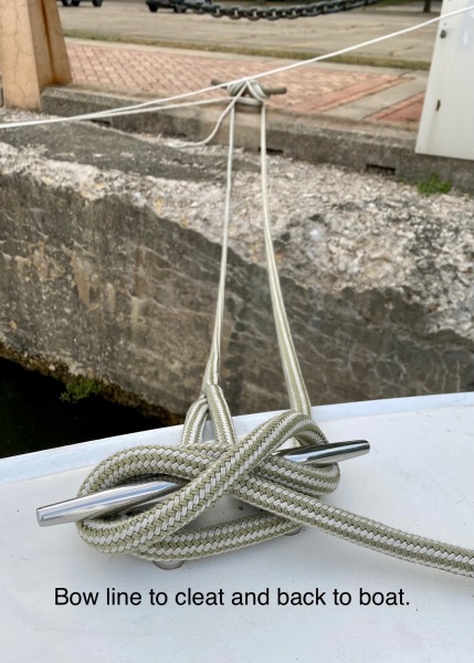
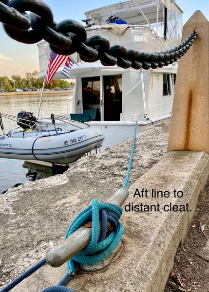
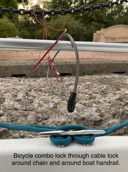
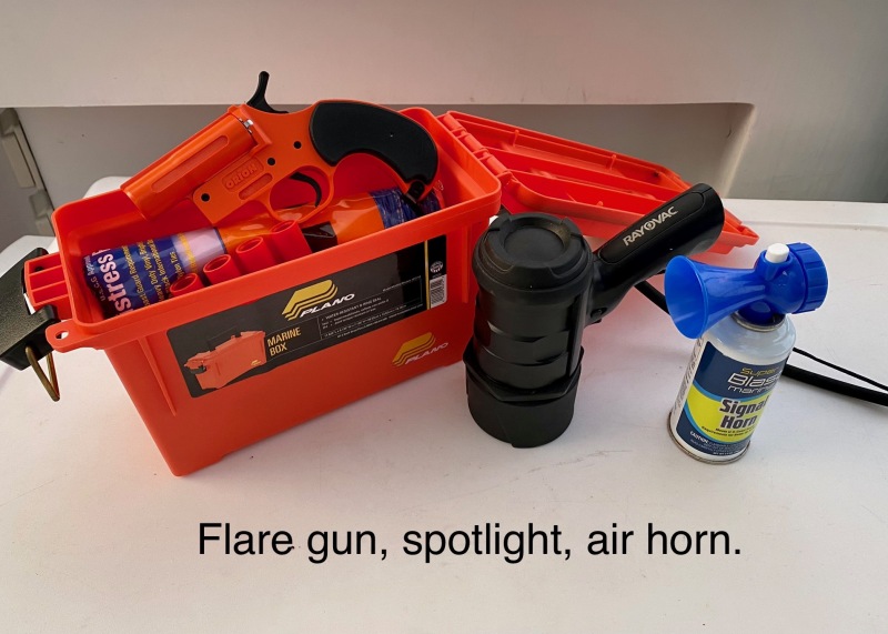
By the evening there were ten boats. We met the crews and shared a few stories and then discussed some knowledge of the security concerns in this area. There had been some vandalism in recent weeks. The police department is directly across the river and they routinely patrol the public park. Still, it was recommended to bring lines back to the boat, remove and store valuable items on the decks and consider a cable lock if one was on board. We hatched a plan that if any boater heard a disturbance, s/he would blast their air horn five times to wake the other boaters. We all had flares and spotlights that were positioned for quick deployment. I am happy to report that nothing happened.
Our second day on the river offered some more excitement. Six boats left the Joliet City free wall at 07:00 having coordinated the timing of the bridge lift and the subsequent Brandon Lock and Dam. Four boats took the lock bollards and two rafted up to the larger boats. Reverie was placed at the back of the group, very close to the lock gate. There was a large shelf of cement that worried me but Pete, with his birds-eye-view reassured me that our dinghy would be fine.
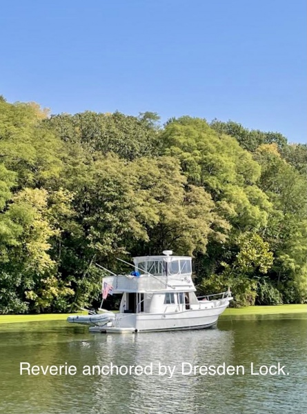
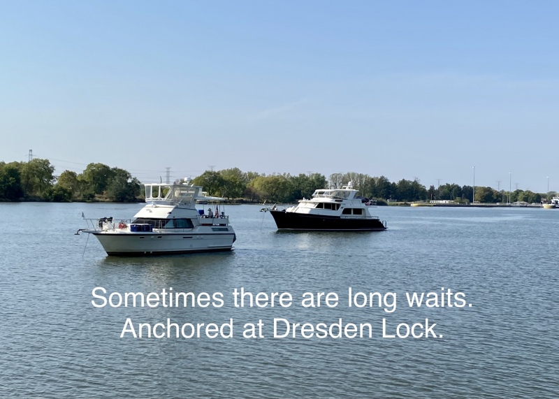
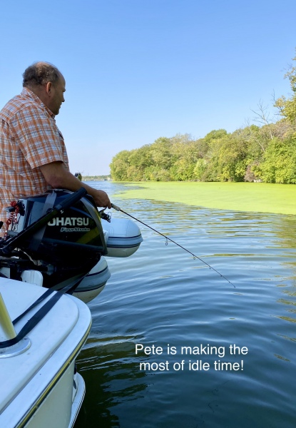
The next few miles were very pleasant. When we arrived to Dresden Lock, we were told to expect a wait. The lockmaster said, “It’ll be a while.” We tried to get a more definitive time frame but it was not forthcoming. Eventually, most of the eight boats trying to hold position decided to drop anchor while waiting for the barges to get through. Two hours became four. It was apparent that we would not make our intended destination before dark. Reverie and Grand Cru decided to stay anchored for the night and transit Dresden Lock in the morning. It was the safe choice.
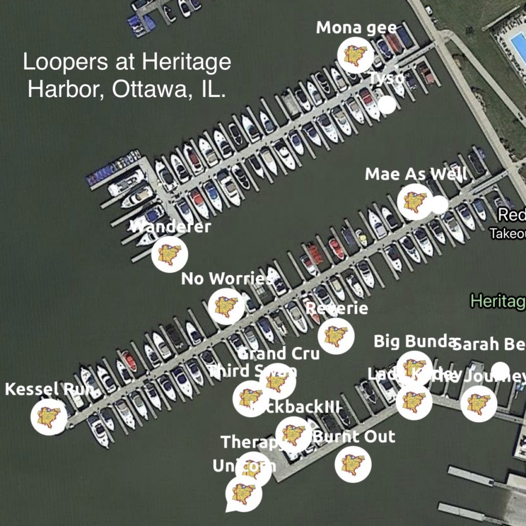
We had no delays through Dresden Lock the next morning. With an early start, we arrived to Heritage Harbor about 11:30 a.m. We fixed a sandwich then rested as we watched the progress of other boaters on the NEBO tracking app.
This harbor offers a Route Briefing from Ottowa to Padukah. Harbormaster Jeremy provides a fast-paced and detailed explanation of what to expect for the next several hundred miles. He warned us that the briefing could get interrupted if other boaters needed assistance during our presentation. Sure enough, at 6:30 p.m. Jeremy received a radio call for three boats that were due in, delayed by both Dresden and Marseilles Locks. (It was dark.) He apologized to his attendees then he got into his small pontoon boat to meet the boats on the river and lead them in to their slips! I’ve never heard of such a thing! Numerous staff appeared to secure their tie ups. Superlative service!
Lady Kadey was one of the late arrivals. It was great to see Colleen and Tony again! We reserved a table at the Red Dog Grill knowing that none of these boaters would feel like cooking a meal.
The crew from ARGO joined us and shared some heartwarming tales. It was but a brief glimpse into the lives of three travelers (Carl, Bob and Jennifer), each of whom could write a book about their triumphs over tragedy. All could be best sellers! I wanted to hear more but they would be out on the river early for their next destination. At the end of dinner, we wished them well with hopes of crossing paths another day.
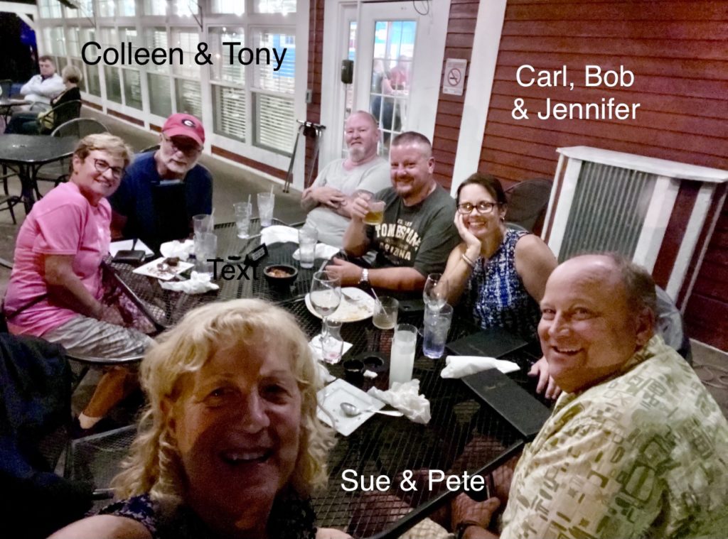
Courtesy cars were available to transient boaters and we took advantage of this! Colleen and Tony joined us for a trip to Kroger’s grocery for reprovisioning. Our second trip took us to “the #1 Attraction in the State of Illinois.” Starved Rock State Park was a short 14-mile drive to some wonderful scenic hiking trails and interesting Native Indian history. We chose a moderate hike that included paved and dirt trails, some two or three dozen staircases and grand vistas of the Illinois River. It was well worth our time and effort.
We joined Jeremy that second evening for the second half of the Route Briefing. This time the meeting room was packed. There must have been at least 18 Loopers in the marina. Armed with five pages of abbreviated notes and Jeremy’s cell phone number, we felt ready to tackle the next segment of our trip.
I am eager to tell the story of the second half of the Illinois River. It gets better around every bend!