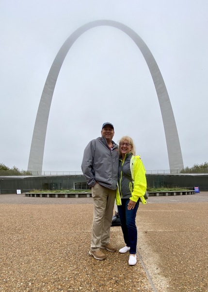
It was a short jump from Grafton (on the Illinois River) to Alton (on the Mississippi River). We planned a longer stay at Alton Marina to wait out a weather system. We read books, did some more boat cleaning, I sketched, but on the third day Pete made the spontaneous decision to get a one-day car rental to drive into St. Louis. We called Tony and Colleen and within the hour we were in the rental car and driving to the Gateway Arch!
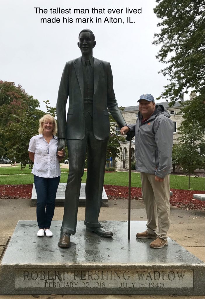
On the way out of town, we stopped by a monument dedicated to “Alton’s Gentle Giant.” Robert Wadlow was 8 feet, 11.1 inches tall, and the tallest man ever to walk the earth. Born February 22, 1918, he came into the world at normal birth weight. He had a pituitary disorder that produced excessive human growth hormone. His death at age 22 was related to an infection. In his short life he made quite an impression on his community and indeed, the world.
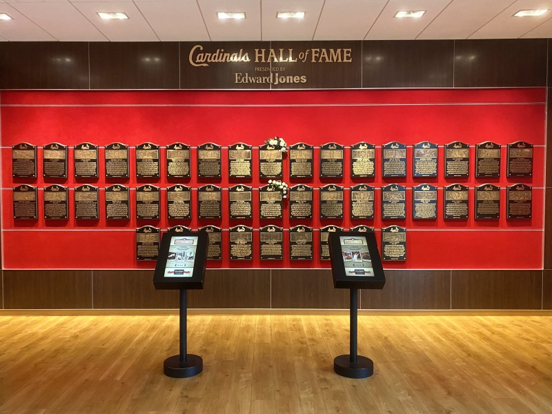
Tickets for a tram ride to the top of The Gateway Arch were sold out for the day, so we enjoyed the museum and then a tasty lunch at Pickle’s Deli. We walked the downtown and to Busch Stadium, home of the Cardinal’s Baseball Team, then passed by the Cardinal’s Hall of Fame before returning to Alton. We managed a grocery stop before Pete returned the rental car, in a downpour.
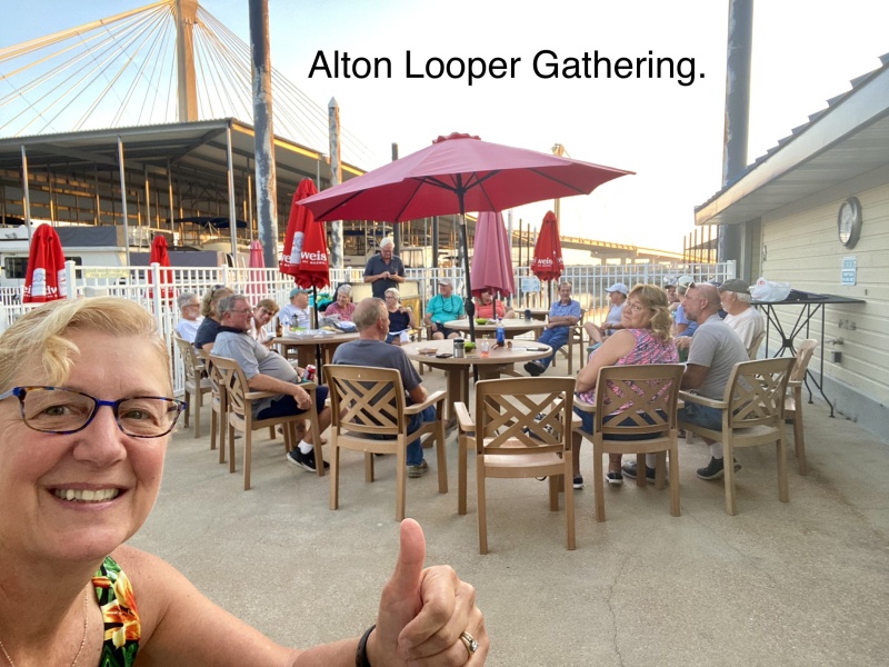
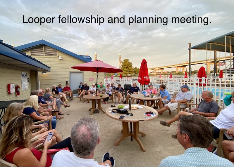
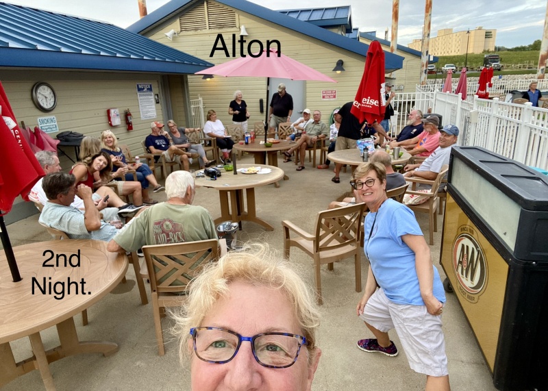
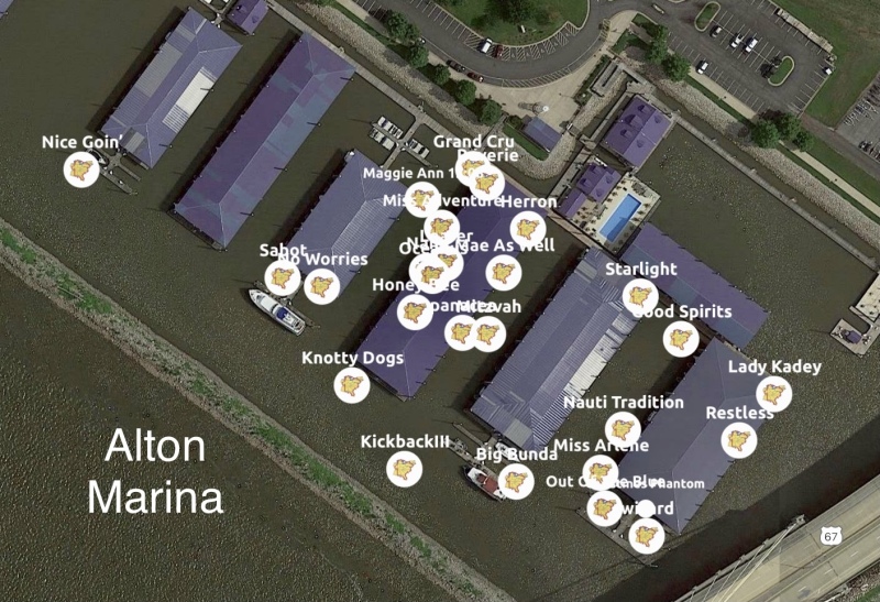
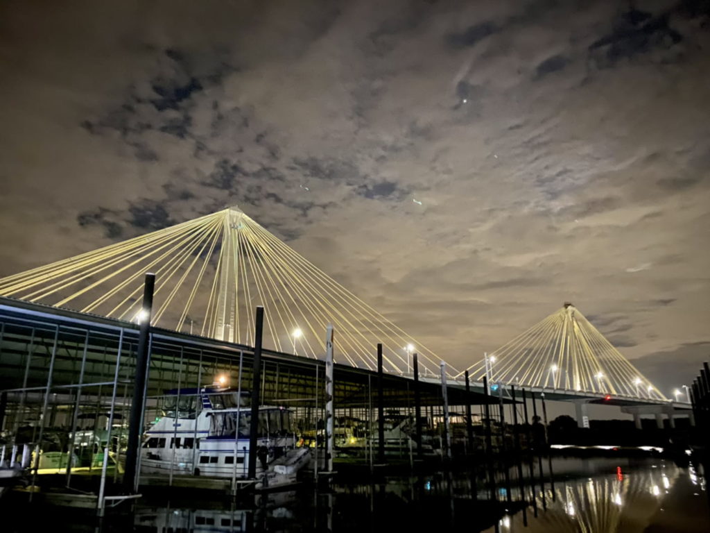
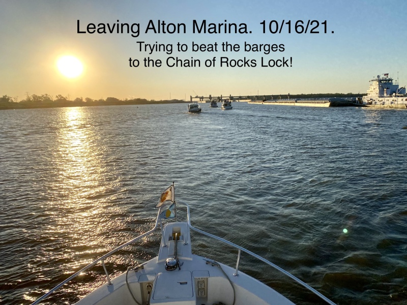
Alton Marina provided space for an informal Looper gathering each evening. This meeting was helpful for two reasons: it allowed for Looper fellowship and it provided an opportunity for any departing boat captains to synchronize morning plans. The Chain of Rocks Lock (a.k.a. Lock and Dam 27) appreciates a coordinated group of pleasure craft. The protocol is for one boat captain to take the role of group leader, communicate with the lockmaster early (usually around 06:00) and then pass information on to other pleasure craft (on VHF chat channel 68 or 69). All boats should be ready to leave immediately or, if commercial traffic is imminent, the group leader passes the order to hold-in-place at the marina until the lock is ready.
Once the convoy of pleasure craft get the OK to proceed, it’s like a slow-poke version of the Indianapolis 500. (“Captains, start your engines!“) All the boats politely exit the marina and head south at trawler speed. At the northern tip of Gabaret Island there is a large sign indicating that the Chain of Rocks Lock is to the left. Here is where Jeremy at Heritage Harbor advised us, “For the love of God, go LEFT!”
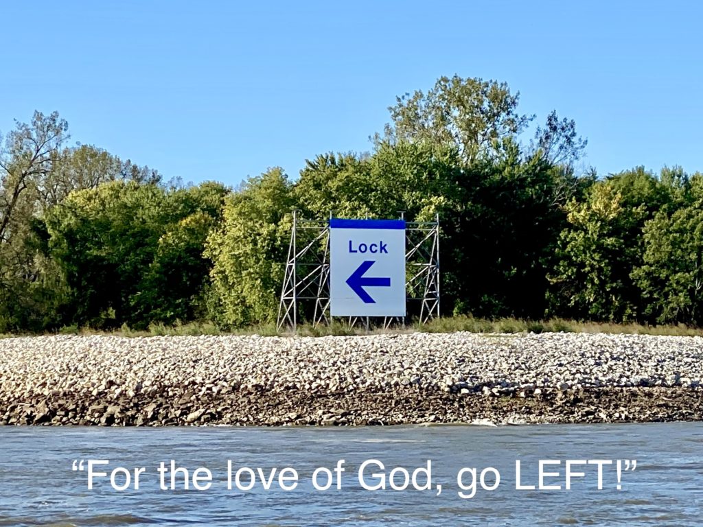
This is the start of an 8.4 mile man-made canal that takes boaters around the treacherous rocky stretch of river known as the Chain of Rocks Reach. We followed the sign. One boater (a few days before us) did not. Perhaps distracted, he made a wrong turn and grounded his sailboat on the rocks, until a storm sunk his boat.
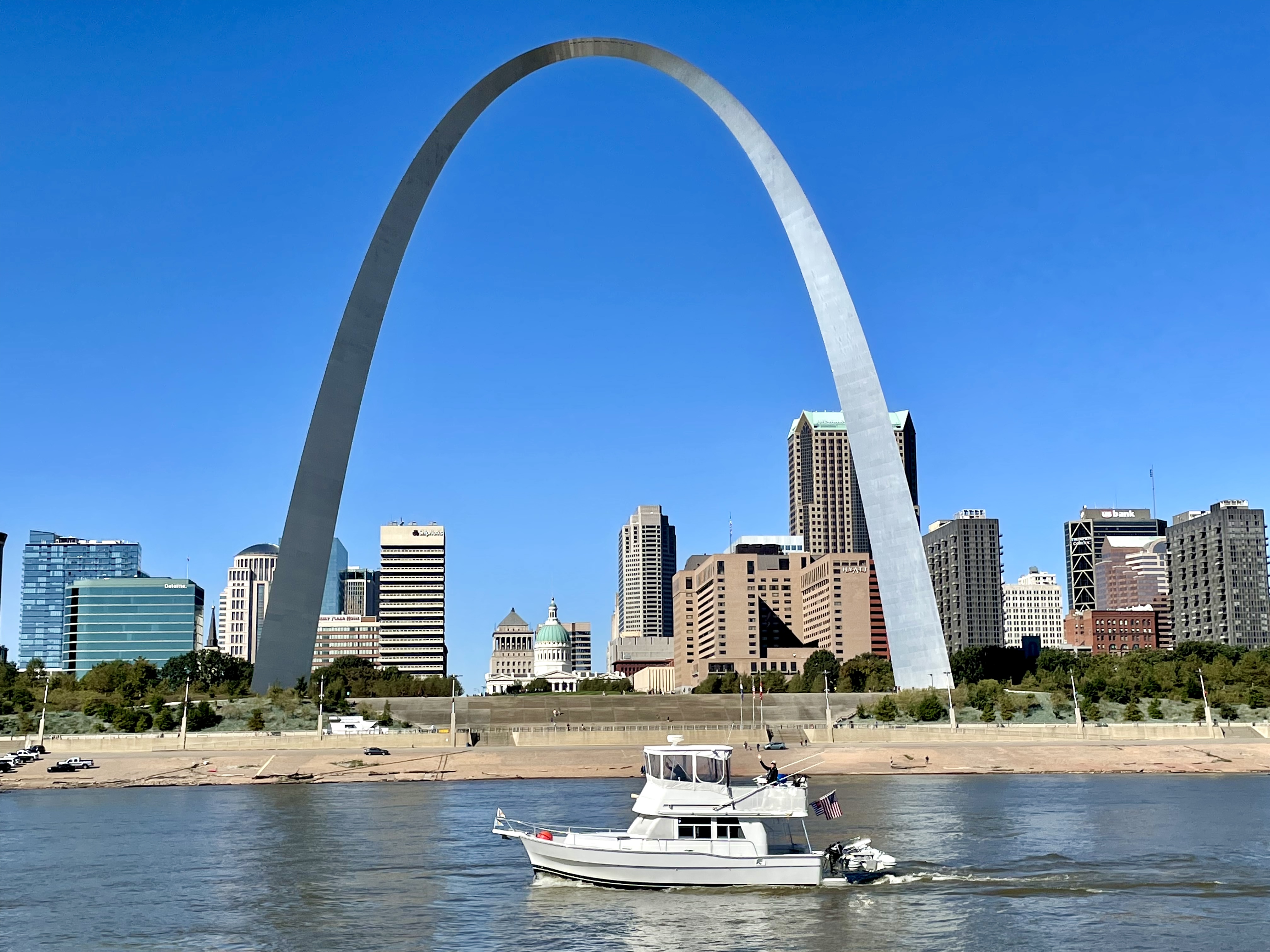
As Loopers approach St. Louis, most have worked out a buddy boat plan to capture the image of their boat at The Gateway Arch. Sometimes boaters have to circle around due to barge traffic, and occasionally clouds obscure the top of the arch. We lucked out! It was a beautiful sunny morning and Lady Kadey snapped a great photo of Reverie.
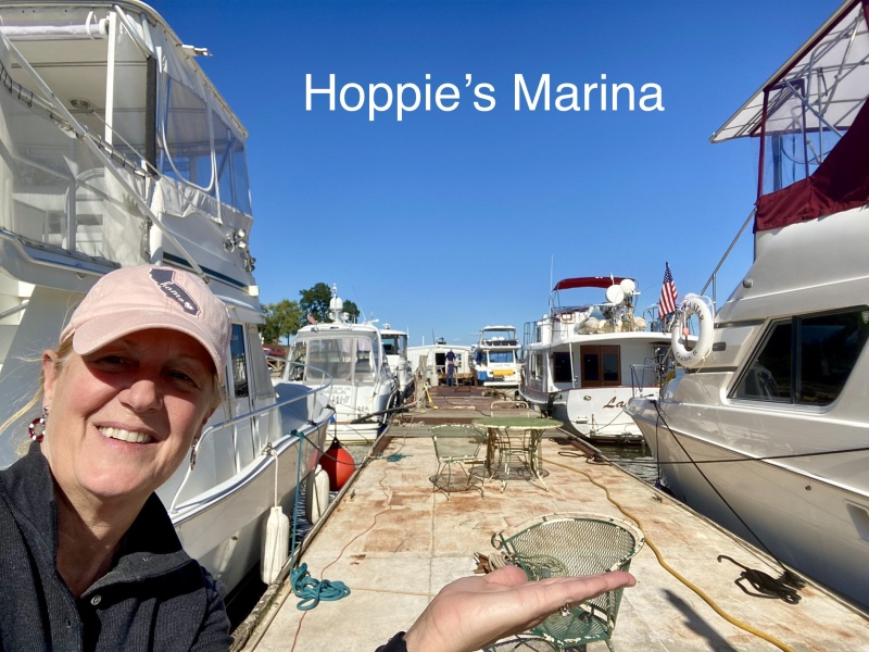
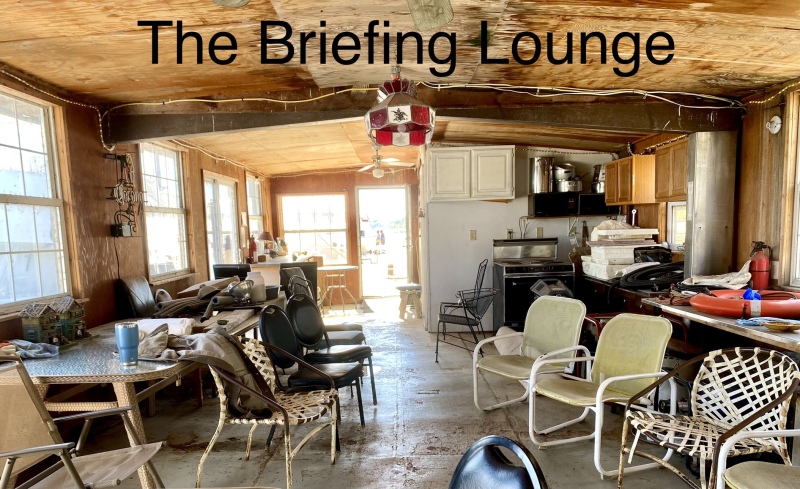
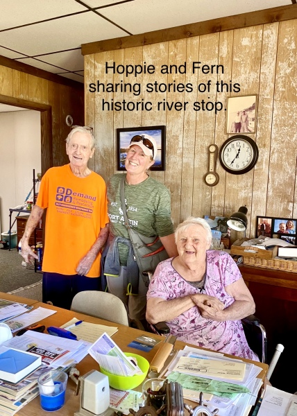
We continued south to Hoppie’s Marina at Imperial, Missouri, just outside of the town of Kimmswick. This isn’t a typical marina although it is a rustic and iconic stop for many Loopers. Three large steel barges are tied to shore with chain and cable. There is power and water, and it offers the last fuel available for the next 250 miles. Fern Hopkins, in her mid-80’s, used to give a daily afternoon route briefing. Now her daughter, Debbie, provides this informative session. Fern’s husband, simply known as “Hoppie,” has also turned over daily duties to a well-qualified staff. I had a chance to meet Fern and Hoppie, both in fragile health but clearly passionate about their love for, and service to, the boaters of the Mississippi River.
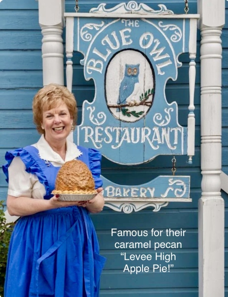
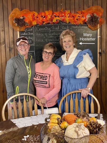
The acclaimed Blue Owl Restaurant and Bakery is a half mile walk into Kimmswick. Mary Hostetter turned her home baking business into a thriving and award-winning enterprise. (I encourage you to read her story!) We made the short trek to town and had a fabulous late lunch, met Mary and her attentive staff, and purchased bakery sweets for the boat. There are several other cute shops that we browsed as we walked off some calories. We made it back to the barge just in time to catch Debbie’s Route Briefing (Hoppies to Padukah). We learned to pay close attention to Mile Markers, where the prime anchorages and emergency stops were, to stay to the edge of the channel when passing barges to avoid turbulent prop wash and debris, and to exercise patience on foggy mornings. It is better to remain tied or anchored than to travel blindly on the Mississippi River.
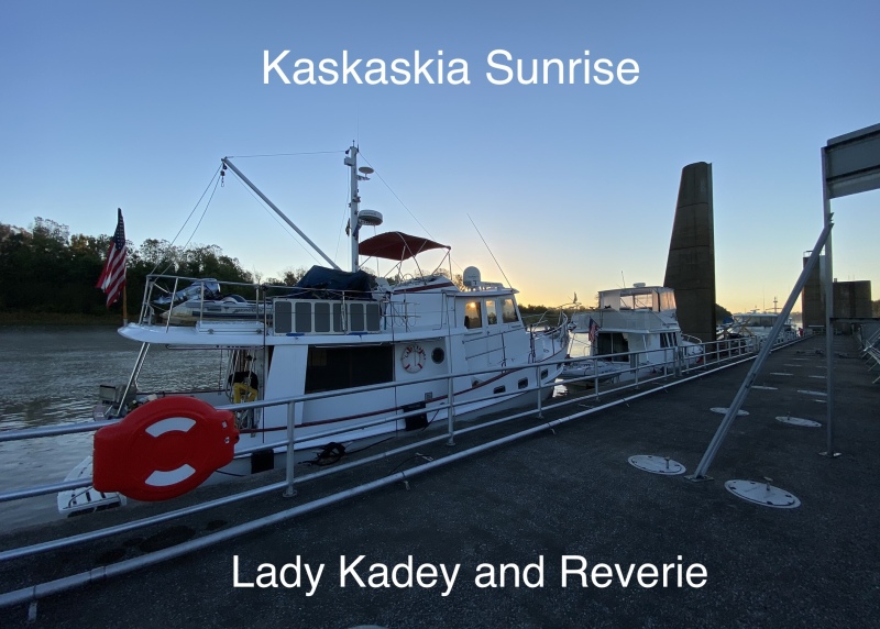
After the fog lifted, we ventured to Kaskaskia Lock Wall for a tie up without services. This is a first-come, first-served safe place for about eight (8) boats of average Looper size. If the wall is occupied, rafting up or anchoring is an option.
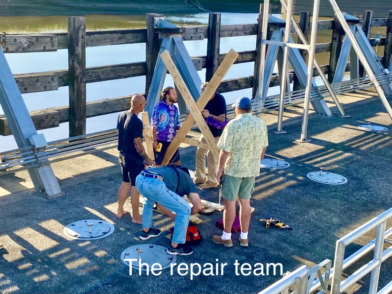
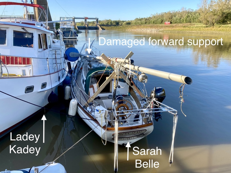
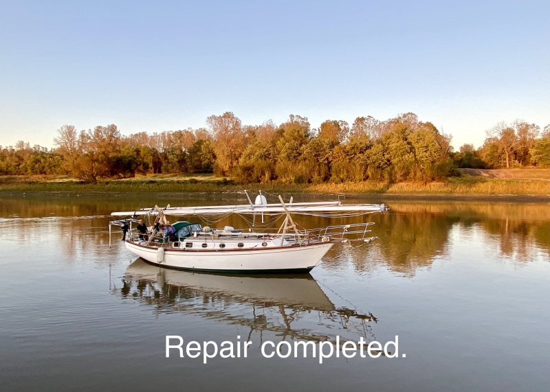
We heard from our friends on Grand Cru (ahead of us now) that our non-Looper sailboat friends, Darwin and Adi on Sarah Belle, encountered some really rough turbulence from the wake of a barge. The forward cradle for her mast was damaged. There are several engineering geniuses among us that figured out a way to help Sarah Belle. The dinghy hoist on Lady Kadey gently lifted the mast to allow a team to repair the cradle and secure the mast so that Sarah Belle can continue her voyage!
We had our sights set on Padukah, KY (on the Ohio River), but the distance required two anchorages as there are no recreational marinas in between.
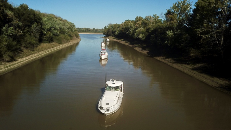
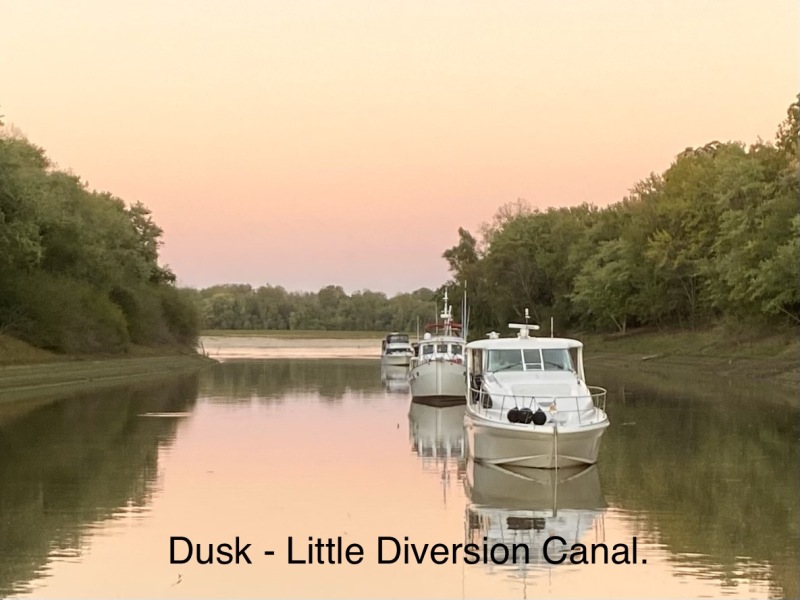
Our first night was delightful at Little Diversion Canal, also called the Castor River Diversion Channel at Mile Marker 49 on the Right Descending Bank of the Upper Mississippi River. This anchorage is about 69 miles downriver from Kaskaskia Lock, longer mileage than we normally travel but since we were going with the current our average speed was better than 10 knots! We were joined by Nauti Tradition, Lady Kadey, Starlight and TYSO. Pete launched our drone to capture the serenity of this anchorage.
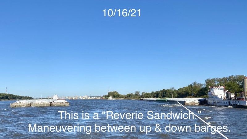
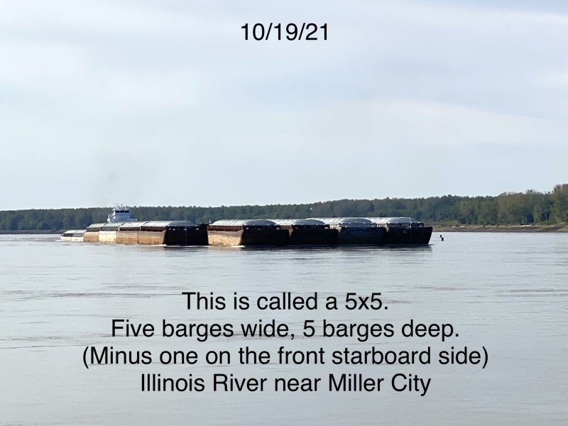
The next day (10/19) we turned a corner, literally! We traveled 49 miles south on the Upper Mississippi River (with the current) and 16 miles east on the Ohio River (against the current). We went from a 3 knot advantage to a 3 knot resistance. These 65 miles involved dodging lots of barges, but we’re very comfortable around them now.
We stopped and anchored short of the Olmstead Lock, in the construction basin, having learned of barge delays. We would rather travel first thing next morning instead of traveling after dark as many regretful Loopers had done at Dresden Lock. It wasn’t particularly scenic but quiet enough and we had put in a long day.
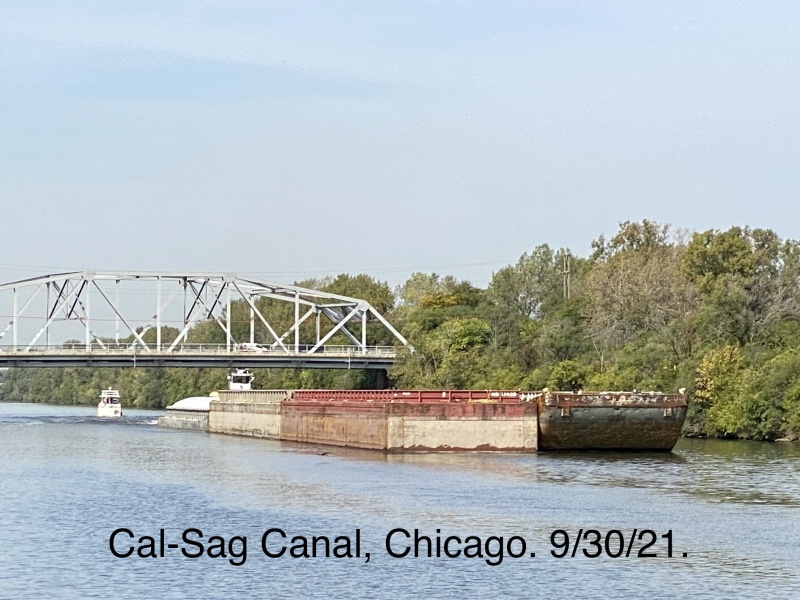
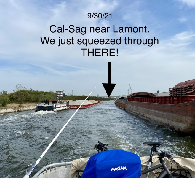
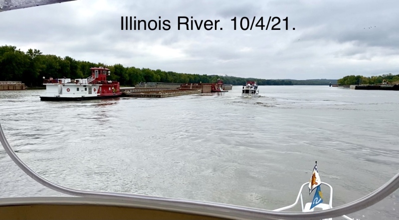
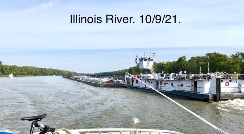
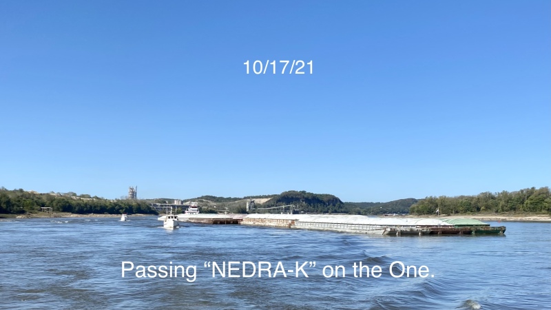
I will close this post with a gallery of the many barges we’ve seen. Next post will detail the Ohio River, the city of Padukah, the Cumberland River, and through Barkley Lock to Green Turtle Bay.
Wow! How fun to be “in the loop” again…sure missed your stories. I wish I had recomended you seeing Kahokia Mounds…300 to 800 year old Indian settlements in East St Louis. I begged my St Louis relatives to take me there when I visited every 3 years or so. Finally in 2008, after a 5 million dollar museum was built, we went. I think I remember climbing STAIRS to the top of the arch in 1963. I remember riding the ADMIRAL, a futuristic looking cruise ship with a steam calliope up to Alton and back on a swollen Missisippi, hitting and chewing up 15′ logs, plowing thru the scary 2′ rollers. Made the whole boat wobble! I am so proud to be included in your wonderfully detailed adventure. Love ya! Stay safe!